


Dear all,
I read a comment about the Battle of the Somme, and I was wondering if
anyone could confirm it.
According to an encyclopedia, the first day of the Battle, saw the biggest loss of men suffered by the British in one day.
I was wondering if this meant "of the war", or "up until that time", or if the record still stands. Has the British ever lost as many or more men in one day since 1916?
Lisa Vedeckis, WWI-L
A good source for breakdown of these casualties is Middlebrook, The First Day Of the Somme where he details percentage officer casualties, also lists the number of senior ranks who were killed, and lists the battalions that suffered more than 50% casualties.
Steve Baldwin
WWI-L co-owner
(steve.baldwin@telematics.com)
Denis McGurin
DM2193A@american.edu
In terms of number of men killed in a single day, you need to go back considerably further in time. The bloodiest single day in British (English to be precise) history was the Battle of Towton, when Edward IV won the crown on a storm swept Yorkshire moor. Even modern scholars put the death toll at around 28,000, mostly from the defeated Lancastrian army. The number of wounded would have been considerable less, since in the fifteenth century a serious wound would have usually resulted in death.
Gervase Phillips
G.Phillips@mmu.ac.uk
From Irene Moore, The Armourer magazine for militaria collectors
(http://www.smart.co.uk/armourer/)
This was to be the battle which broke the tedium of trench warfare and opened the way for the cavalry to roll up the enemy. It had been planned down to the last detail...
7.28 am
Three large and seven small mines were blown, the biggest were two either
side of the road at La Boisselle, each containing 24 tons of
explosive. One would form the largest crater on the Western Front,
Lochnagar.
7.30 am
Zero Hour
The British barrage which had pounded the German trenches for a week with
one and a half million shells fell silent and over some parts of the line
bridsong was heard. The men who had been waiting in No Man's Land rose up
and those in the trenches clambered up ladders and over the parapet and
began to walk at a steady pace, as they had been instructed, towards the
German trenches. Capt. Nevill (later killed in action) and some of
his platoon commanders of the 8th East Surreys kicked footballs into
No Man's Land.
7.30-8.30 am
Far from being knocked out by the intense artillery barrage, the Germans
were waiting and as the guns fell silent they came from their deep dug-outs
to man the trenches and the machine guns, pouring a withering fire into the
slowly advancing troops. The wire, which should have been cut by the long
preliminary bombardment was in many places virtually intact and as the
heavily burdened infantrymen - each carrying around 60lbs of equipment -
struggled to find a way through they were mowed down by the German gunners.
Second and third waves of infantry followed, while those fortunate enough
to survive the machine guns and reach the German trenches fought savage
hand-to-hand battles.
8.30 am-Noon
Eighty four battalions had attacked in the first hour, a total of about
66,000 men. Of these it is estimated that around half were casualties after
the first hour. On the right the 30th, 18th and 7th Divisions
attacking alongside the French had attained almost all their objectives and
were fighting towards the village of Montauban. The 36th (Ulster)
Division too had successfully reached the second line German trenches
near to Thiepval.
However, the attack astride the road to Bapaume had been repulsed with very heavy casualties. During the morning, adhering to the rigid timetable of attack, more waves of infantry poured into the maelstrom, whilst a steady stream of wounded made their way to the rear. The 1st Newfoundland Regiment at Beaumont Hamel fared amongst the worst that day. Ordered into the attack from the reserve trenches, they had to advance over open ground and withstood a hail of fire as they negotiated the British wire. The attack lasted 40 minutes during which 91 per cent, 26 officers and 658 men, had become casualties.
Noon - 2.30 pm
By now it is estimated that nearly 50,000 British soldiers had been killed
or wounded, while the survivors of the early attacks were desperately
hanging on to the positions they had gained and waiting for reinforcements
or new orders. Hundreds of wounded occupied the smashed trenches, shell
craters and the medical services were working at full stretch.
2.33 pm
The 17th (Northern) Division was ordered to attack Fricourt.
As the men climbed out of the trenches a German machine gun opened fire. In
three minutes 123 men had been killed or wounded.
3.00 - 3.30 pm
At Gommecourt on the extreme left the 46th (North Midland)
Division was ordered to attack. At the last minute it was called off
but the message did not reach one platoon which attacked. Every man except
one was hit.
By mid-afternoon the Ulster Division which had achieved success in the Schwaben Redoubt was exhausted and running short of ammunition. Under fire from the village of Thiepval they were hanging on by the skin of their teeth. Mametz fell to the 7th Division after a hard fight.
4 pm-9 pm
The London Division which had successfully taken its objectives at
Gommecourt had been forced back to the German front line trench.
From the seven battalions which had attacked that morning over 1,700 were
dead, 200 were prisoners and 2,300 were wounded. By nightfall they had to
give up all they had gained and retreat back to the trenches they had left.
9.30 pm
The Ulster Division, down to their last few rounds of ammunition,
were forced to retire from the Schwaben Redoubt to the German front
line and as they did so they met the reinforcements they had waited for all
day, only now being able to cross No Man's Land. Over 2,000 men from the
province of Ulster died by Thiepval, 2,700 more were wounded
and 165 were taken prisoner. It was to be more than three months before
British troops took
the Schwaben Redoubt again.
Aftermath
The first day on the Somme remains numerically the worst military disaster
ever to have befallen the British Army. The final return showed a
casualty list of 57,470 - 19,240 killed; 35,493 wounded; 2,152 missing; 585
taken prisoner.
It has been estimated that German losses for the day were about 8,000 including 2,200 taken prisoner.
Maps of the SommeCourtesy of Trenches on the Web and Battery Books, two maps of the Somme, for 30 June and 1 July 1916, and a 'zoomable' map of the battlefield.
Recommended
Reading
The Battles of the Somme, 1916: Historiography and Annotated Bibliography
Complied by Fred R. van Hartesveldt. ISBN 0-313-29386-4, ISSN 1056-7410
Greenwood Press - 1996
702 detailed citations from both sides of the battle.
Johnson, J.H., Stalemate! The great trench warfare battles of 1915-1917, Arms and Armour Press, London 1995.
Keegan, John, The Face of Battle, Penguin, 1976, Penguin.
Examines Agincourt, Waterloo and the Somme.
Liddle, Peter, The 1916 Battle of the Somme -- A Reappraisal, (Leo Cooper), 1992.
Middlebrook, Martin, The First Day Of the Somme, 1 July 1916, Norton, 1972
Note: The number of officers and other ranks who went over the top on July 1 was 790. Of these 80 survived unwounded (some getting mixed up with other troops and not turning up for a day or two after. 710 officers and other ranks were killed or wounded in this attack, more than any other Battalion on the Somme, and equal to the casualties of the 10th West Yorkshire Regiment at Fricourt. This diary should be compared to that of the 1st Essex Regiment who were to attack, along with the Newfoundland Regiment at 0920 July 1, 1916 (below). Trench maps of the front are available.
David Parsons, dparsons@morgan.ucs.mun.ca
30/6/16 - Draft of 66 men arrived from Base. Regiment marched off at 9.15 P.M. from forming up place in trenches,i.e. rear line of trenches in our usual sector. (Marched from Louvencourt to near Mailly-Maillet -ed.).
March to trenches about 8 miles. In position at 2 A.M.
In addition to above, 22 men with the 88th.Bde. M.G.Coy. and 1 officer and
11 other ranks with trench mortar Battery took place in the battle on July
1.
A.L.Hadow, Lt.Col.
Commanding, 1st.Newfoundland Reg't.
1/7/16 - General attack all along line.
0600 St.John's Road. Intense bombardment.
0730 86th. and 87th. Brigades attacked 1st. system of enemy trenches.
88th. Brigade under pre arranged orders were to move forward at 0840 to attack 3rd. line system of trenches. About 0820 received orders not to move until further orders. Presumably first attack not having been successful.
0845 - received orders on telephone to move forward in conjunction with 1st. Essex Reg't. and occupy enemy's first trench, our objective being point 89 to just north of point 60 and work forward to Station Road, clearing the enemy trench and move as soon as possible. Ask Brigade if enemy's first trench had been taken and received reply to effect that the situation was not cleared up. Asked Brigade if we were to move off to attack independently of the Essex Reg't. and received reply in affirmative.
0955 - reported to Brigade that Newfoundland Reg't. was moving off. It was subsequently found that the Essex Reg't. did not attack until 0955, ie, after our attck had failed.
The Regiment moved off in previously arranged formations, i.e., A and B Coy., A on the left in the first line in lines of platoons in file of single file at 40 paces interval and 25 paces between sections, followed by C and D Coy. in similar formation at 100 yards distance. C Coy. had been specifically detailed as consolidating Coy. and therefore carried additional equiptment.
The advance was made direct over the open from the rear trenches known as St. John's Road and Clonmel Avenue. As soon as the signal for advance was given, the Regiment left the trenches and moved steadily forward. Machine gun fire from the right front was at once on us and then artillery fire also. The distance from our objective varied from 650 yards to 900 yards. The enemy's fire was effective from the outset but the heaviest casualties occured on passing through the gaps in our front wire. The men were mown down in heaps. Many more gaps in the wire were required than had been cut. In spite of the loses, the survivors steadily advanced until close to the enemy's wire by which time very few remained. A few men are beleived to have actually succeeded in throwing bombs into the enemy trench.
0945 - the C.O. reported personnally at Brigade H.Q. 100 yards behind our firing line that the attack had failed. Shortly after, the enemy opened an intense bombardment of our trenches with heavy artillery which was kept up for some time. During the night and evening unwounded survivors managed to crawl back to our lines and by next morning 68 had answered their names in addition to stretcher bearers and H.Q. runners.
0945 - During the afternoon, the 10% reinforcements under Cap't. Forbes-Robertson arrived in the trenches and orders were received to occupy the support trench in the right subsection known as St. James Street, where we remained on July 2.
3/7/16 - Moved to support trench in the left subsection known as Fethard Street. At night brought in some dead and equiptment. Orders received to be prepared for counter attack and gas.
A.L.Hadow, Lt.Col.
Commanding, 1st.Newfoundland Regiment.
The 1st/Essex War Diary for the 1st July 1916.
The format is that of the entry in the typed-up copy of the diary held by the Essex Regiment museum in Chelmsford, England. The original maps are not attached.
1st Battalion, The Essex Regiment

=========================================================

1916
July    Trenches
1st

	  List of officers who took part in the attack
	  on July 1st 1916.

	  Lt.Col.A.C.HALAHAN
	  Capt.F.C.DINAN
	  Capt.A.D.HENDERSON (W).
	  Capt.G.A.M.PAXTON
	  Capt.T.A.C.BRABAZON (W)
	  Capt.A.N.W.POWELL.
	  Lieut.H.A.HARVEY.
	  Lieut.R.E.G.CAROLIN.
	  M.O.Capt.F.SAUNDERS.
	  Lieut.F.F.COOKE (W)
	  2/Lieut.W.R.CHESHIRE (K)
	    "  R.B.HORWOOD (K)
	    "  E.T.H.HILL (W)
	    "  H.A.JACKSON (W)
	    "  A.J.MORRISON (W)
	    "  B.O.WARNER (W)
	    "  W.J.McLEAN
	    "  A.COUCHER (BATTLE POLICE)
	    "  A.F.CHAWNER.
	    "  C.P.LAWSON.
	    "  G.A. APPS.
	    "  M.C.W.KORTRIGHT.
	    "  A.GRANT.
	    "  B.HULL.
	    "  F.R.WHEATLEY.
	    "  J.T.BROOMFIELD.
	  Other ranks strength 840.

     3.30 Took up position in ST.JOHN'S
     a.m. ROAD (ref. Trench Map) as
	  follows:- W.Coy's right on
	  FRENCH trench Z, Y and X. X Coy's
	  left being on UXBRIDGE ROAD.
	  Men much fatigued by long time
	  (9 p.m. 30th - 3.30 a.m.1st) it
	  had taken to get into position
	  and heavy equipment carried.
     6.0  Intense Artillery bombardment
     a.m. commenced.
     7.20 Mine exploded under HAWTHORNE
     a.m. REDOUBT.
     7.30 86th and 87th Brigades left ouy
     a.m. 1st line trenches to assault
	  their objective. Heavy
	  artillery, and Machine Gun fire
	  and difficulty of getting
	  through our own wire caused
	  these Bdes. very heavy losses.
	  Very few men survived long enough
	  to enable them to reach half way
	  across "NO MAN'S LAND".
     8.40 Orders received cancelling our
     a.m. previous objective and ordering
	  ESSEX and NFLDs to advance and
	  clear up German 1st line trenches.
	  Worcs. and Hants. remaining in
	  reserve.
	  N.F.L.Ds. were ordered to
	  advance to the attack from
	  their positions in ST.JOHN's
	  ROAD. ESSEX, owing to ground
	  between ST.JOHN's ROAD and
	  our front line, being under
	  heavy fire, were ordered to
	  advance via communication
	  trenches and take up a position
	  in our front line from which
	  to commence the assault.
	  Essex and NFLD. Regt. to
	  advance  to the assault
	  independantly as soon as they
	  were ready.
     8.45 Orders issued to Coys. to take
     a.m. up the following positions:-
	  Y.Coy. with its right on
	  point 100 yds. N. of MARY REDAN.
	  X.Coy. to prolong to the left.
	  W. and Z.Coys, being in support
	  trenches. NFLD. on the left
	  were seen to advance from ST.
	  JOHN's ROAD and immediately
	  came under very heavy Arty. &
	  M.G. fire, which practically
	  wiped them out before they had
	  gone many yards beyond our
	  front line.
    10.50     Y.Coy. reported that they were
     a.m. in position in touch with W.
	  Coy. Z.Coy. had taken up a
	  position between X & Y Coys.
	  Owing to the congestion of the
	  trenches due to being chocked [sic?]
	  with wounded and badly damaged
	  by shell fire, it had taken
	  Coys. two hours to get into
	  position. Orders issued to
	  Coys. to attack. Coys. came
	  under heavy Arty. M.Gun barrage
	  immediately they appeared over
	  the parapet, causing heavy
	  losses. Report received from
	  O.C. X.Coy. that our wire on
	  his front was uncut, that
	  further advance was impossible,
	  and that he had suffered heavy
	  casualties. Z.Coy, in centre
	  was able to make better progress.
	  One platoon under 2/Lt.CHAWNER
	  getting about half way across
	  NO MAN'S LAND. W.Coy.
	  attempted to support, but were
    11.10     unable to make much progress.
     a.m. 11.10 a.m. Lt.SKITT, R.F.A.
	  attached, learned from his
	  group, that a re-bombardment of
	  the 1st German line was ordered
	  from 11.10 a.m. to 12.20 p.m.
	  Orders to cease the attack and
	  reorganise in ST.JOHN's ROAD,
	  but it was only possible to
	  convey the message to Z.Coy.
    11.30     Communications established with
     a.m. Bde. and orders received to
	  renew the attack at 12.30 p.m.
    11.55     Orders issued to Coys. to
     a.m. reorganise for the renewal of
	  attack at 12.30 p.m.
    12.20     Message received from Bde.
     p.m. postponing the attack to 12.45
	  p.m. Brigade informed that
	  owing to casualties and
	  disorganisation, it was
	  impossible to renew the attack
	  until we had had time to
	  reorganise. Subsequent orders
	  received, cancelling the attack
	  and ordering us to hold the
	  line MARY REDAN - NEW TRENCH -
	  REGENT STREET. Getting in
	  touch with the Nors. on our
	  left and the 36th Div. on the
	  right and be prepared to repel
	  counter attack. Bn. occupying
	  above position with one Coy.
	  in support in ST.JOHN's ROAD.
     3.30 Orders received that 7th Worcs.
     p.m. were to relieve us in the
	  firing line. Coys. on relief
	  were to go into ST.JOHN's ROAD.
    10.30     Head of Worc. arrived at
     p.m. KNIGHTSBRIDGE and Coys. notified
	  and ordered to move.
    11.40     Relief cancelled and Coys.
     p.m. ordered to resume their previous
	  positions.
Philip Curme
On the 1st July 1996 the flag will be flying in front of the Memorial Hall
in remembrance of those men who lost their lives during the Battle of the
Somme. On the 1st July 1916 - 80 years ago 37,000 men were killed or
wounded - most within 30 minutes of the opening assault. To quote a
contemporary diary "line after line of men were knocked down like tin
soldiers swept with a stick". The people of Swavesey paid a heavy price
for this folly.Of the 85 Swavesey men who served in The Great War of 1914 -
1918 no fewer than 26 never
returned.This sad tally included young Jim Prior and Jonas Dodson both of
whom lost their lives during that awful half hour on 1st July. James
William Prior (aged 22) and Jonas Dodson (aged 39) both answered
Kitchener's call in November 1914. The Cambridgeshire Regiment was fully
subscribed so keen to serve, they, like 1400 other men from Cambridgeshire
and the Isle of Ely joined the Suffolks. Initially billeted in Bury St
Edmunds after a couple of months the Cambs contingent were placed in their
own
Battalion (The 11th) housed in the Cambridge Corn Exchange before
transferring to France after a period of training in Yorkshire.
Jim Prior learnt quickly and was promoted to Lance Corporal - He was not yet married and his father was well known as a local chimney sweep. Jonas must have found the move to France difficult - he and his wife had 10 children,7 of whom were below 14 years of age. Jonas's father had died before the war but in his time Charles Dodson had been an accomplished skater and had worked as a bricklayer in St Ives.
The Battalion records show the Cambridgeshire lads behaving true to form during their stay at Renescure in France - en route for the front. "They spend a great deal of their time in inspecting and passing professional judgements on cattle, poultry, and the like....one stalwart got up two hours before reveille today to admire the way the French women milk. The country is just like the fens near Cambridge".
By January the Battalion had moved to the front line - arriving at night. "The darkness was continually illuminated, for a thousand very lights hung from the black velvet sky. Rifle shots and the traversing fire of machine-guns startled the air; monstrous rats came to life from behind the sandbags, scampering boldly...through the mud. A door opened or a sackcloth curtain swung aside, revealing a candlelit dugout....Gradually imperceptibly, the black & white pictures of the night were coloured by the sun. A dark phantasmal mass became a hooded farm wagon, derelict. For a space the war slept. By day there was stillness, broken now and then by a sniper firing suddenly ...or by a bombardment scattering men & things. Day was appallingly prosaic but night was beautiful & romantic. When the lights shot up into the sky the trenches became like fairyland." "Though only a thousand yards away from the German trenches, this spot seemed far away from the war. The undergrowth round the chateau was a riot of wild & garden flowers. Dogs barked at the guns, the vagrant cuckoo called to its mate and nightingales sang through the hours of darkness."
After moving to the Albert sector (ready for the "big push") all was to change for July 1st was a grand and terrible occasion. At the appointed hour a mine consisting of 80,000lbs of explosive was blown up under the German positions near La Boiselle and the 11th Battalion followed the 10th Lincolns into an inferno of blood,smoke & iron. Lads from Willingham, Over, Swavesey, Lolworth, Elsworth... ...following the Grimsby pals. The machine guns in "sausage valley" chattered & "men were spun around and were dropping everywhere."
James & Jonas were killed together. The former died immediately whilst the latter died in the arms of another Swavesey man - Lance Corporal Alfred Linford. (Alfred subsequently lost his life almost a year later during an attack on the chemical works at Roux). Of those Cambs men who survived a handful fought through to the vast crater left by the mine whilst others died storming the Heligoland redoubt.
The Cambridgeshire Independent press reported the news on the 21st July 1916 under the banner "Heroes Of The Suffolks Great Charge" --
...Yet the heavy artillery of the Allies reduced the first German line to rubbish heaps and enabled a considerable amount of ground to be gained at comparitively small cost."
Reading through the obituary columns of that same paper exposes the truth which is very different to the official report. Of the 750 Cambridgeshire men of the 11th Battalion who climbed out of their trenches at 7.30 am 1st July 1916 no less than 691 were killed or wounded on that awful day... So much anguish in Willingham, Over, Swavesey, Lolworth, Elsworth.....
Today at the Lochnager mine crater the fields are still full of the detrius of war. The narrow country roads twist & turn past a myriad of memorials and cemeteries & amongst the fallen are row after row of boys from the fens who gave their lives for King & Country. We should respect them still.
Swavesey, Cambridgeshire, 1996
Population in 1916, less than 1,800
From the Times, 21.6.96:
Eighty years to the day after he was given the order to " go over the top" at the Somme, Robert Burns, 100, will pay tribute to his fallen comrades at the Cameron Highlanders' memorial in northern France.
Mr Burns, a native of Gourrock, near Glasgow, is one of a handful of surviving First World War veterans who are travelling to France on the eightieth anniversary of the opening onslaught on July 1, 1916. By the end of that first day 57,470 men lay dead or wounded, the largest one-day casualty list in British military history. Only 75 out of the 800 soldiers in Mr Burns's 7th Battalion survived the four months of bloody confrontation. By then more than one milion men had died.
Mr Burns enlisted in November 1914 and chose the Inverness based Cameron Highlanders because his mother had bought him a Cameron kilt when he was a boy. The 19-year-old insurance clerk kept a shorthand diary of his entire war service, which he has now presented to the Imperial War Museum, in London.
Mr Burns, who lives in a home in Wokingham, Berkshire, run by a cinema industry charity, said: " I can remember as clear as a bell what happened on the opening day of the battle of the Somme It was four o'clock in the morning when we got the order to go over the top. A fierce bombardment from our side was supposed to have softened up the German lines, but it was quite clear early on that everything was not going to plan."
He survived the Somme but was badly wounded the following Christmas.
At Easter I spent five days visiting the Somme battlefields. I decided, on a Tuesday morning, to go to France the next day. And this is what I did. At the time, I wrote a series of "diary" articles about the visit with the intention of posting them to the List, but I felt that fellow list-members might find this presumptuous of me, and so I didn't post them at the time. Now, however, on the occasion of the 80th anniversary of the opening of the battle, I thought that I might do so. Friends have suggested that those fellow list-members who find it less easy that I do to "nip across for a few days" might appreciate reading about my thoughts and impressions, recorded each evening at the time.
BEAUMONT HAMEL
One of the most symbolic places on the Somme (for me at least) is the Beaumont Hamel area. Together with the village of Serre, a short walk to the North, this area was at the "top" of the Somme offensive lines. (I ignore for the moment, but do not discount or forget, the diversionary attack at Gommecourt, two or three miles further North.)
There is a multitude of impressions, ideas and prejudices about the Battle of the Somme. Depending on the individual's point of view, the soldiers of the Somme were full of genuinely-felt expectation of success, or they were doomed from the very start. They were "the flower of England's manhood" or they were rank amateurs. They were the victims or bad luck, or they were the victims of uninspired leadership. They were heroes, climbing out of their trenches under a hail of bullets and lining up for the slow, ordered advance towards the enemy positions or they were fools. It seems to me that whatever your viewpoint, you will find your proof at Beaumont Hamel.
I parked the car, unhitched the folding camper and prepared my home for the next few days. This done, I sat in the doorway and took in the view.
The fields of the Somme are unusual to English eyes. Large and rolling, they seem to be divided in a quite arbitrary way. One crop will suddenly end and a later or different one will begin. Every square metre of space is used. The fields run right up to the roadsides. There are no fences, no hedgerows, no cover of any kind. The only trees allowed to grow to maturity are those on land which is unusable for farming, so the craters have trees growing on the rims and inside, on the banks. The cemeteries have their deliberately-planted trees and the large trees of the Newfoundland Memorial Park, together with the nearby clump marking the Hawthorn Redoubt mine crater are a notable landmark and orientation point, standing on their high ground and visible from most parts of this area. There are woods on the Somme, but in the Beaumont Hamel area the presence of trees usually signifies a Great War site.
Looking from left to right, I could see the site of the "White City" - a large, flat field nearby. Next came "the Sunken Lane." Beyond, on higher ground, was the crest of the Redan Ridge, its mine-craters marked by trees. Then there were the trees bordering the Hawthorn Redoubt mine crater. To the right of these were more trees, marking the perimeter of the Newfoundland Memorial Park. Each of these places were within ten minutes' walk from where I sat drinking my coffee. One of the first things you notice, on the Somme, is that the distances involved are very, very small. If you look at the first photograph in Lyn Macdonald's book, "Somme" you will see the area I'm describing. Two narrow roads run towards each other from the bottom corners of the photograph and meet in the centre. My camper was set up in the garden of an Englishman, Michael Renshaw, who has bought the land at the very tip of this triangle and built his home there.
THE MINE CRATER
On my first evening on the Somme, I went for a walk. Leaving Micheal Renshaws land, I walked a couple of hundred yards to the position of the British front line of 1st July, 1916 and then a further couple of hundred yards to the Hawthorn Ridge Crater. Here was a formidable strong point, protecting the very edge of the ridge beyond which, sheltering in a little hollow, was the village of Beaumont Hamel itself. The redoubt here would have to be silenced effectively if the attack on this sector was to have any chance of success, and the mine achieved this spectacularly. The crater today is marked by trees, the surrounding fields being cultivated up to the very limits of the rim. Here and there one can see the places where the local farmer tips cartloads of large, flint nodules into the crater. Presumably he and his descendants have been doing this for the past eighty years, but the effect on the crater is absolutely minimal. They would never fill it in this way, not even if their plough turned up flints for a thousand years.
The climb down to the bottom of the crater is a difficult one because of the trees which grow on the sloping sides and at the bottom. There are whole trees here, quite invisible from the surface. And there are brambles and saplings, untended, to trip anyone who makes the descent. The crater receives many visitors judging by the well-worn paths leading up to and around it, but there is little evidence to suggest that many of them risk the scramble to the bottom. When you do reach the tip of this upturned pyramid in space, truly evidence of a world turned upside down, you seem to be in some secret place, moist, windless, shady and almost unbearably quiet.
Time for reflection at the bottom of the crater. This place has special significance for me because of a childhood memory. My grandmother had an illustrated book, which celebrated in pictures the reign of King George the Fifth and Queen Mary. It was a large book, but it chronicled a long and eventful reign, so there was a lot of ground to cover. The editors devoted one double-page spread to the Western Front, 1914-1918, and must have chosen their images very carefully. One of the largest pictures showed the Hawthorn Ridge mine going up on 1st July, 1916 - a huge, towering mushroom of earth. This picture made a big impression on me. I still have the book and can see where I took a pencil and in a childish hand, wrote my name in the portion of sky to one side of the eruption - Tommy. This image, recorded on still and movie film at the moment of the explosion, remains one of the most powerful visual icons of the war and has been used to illustrate countless books and TV programmes, even when the subject has been other battles in other places.
From the bottom of the crater one can see a feature not easily noticeable from the surface - there are really two craters, overlapping each other so that they resemble a figure eight. This is a reminder that the original tunnel used to lay the first of July mine was used again for a second one, in November. Back to the surface.
From here, looking towards the British front line positions, its easy to see the tremendous damage that the defenders of the Hawthorn Redoubt would have been able to inflict upon the the attacking troops trying to cover the two hundred yards or so between their trenches and the top of the ridge. Their position at the edge of the ridge also gave them observation and clear fields of fire over other, more distant parts of the attack front. No wonder so much time and effort was put into extinguishing the position. As soon as the debris had cleared, British troops rushed to take the crater but when they got there, they found that the Germans were already digging themselves in on the far side. The British held the near side for the time being, but had to give up their positions later in the day.
Unbelievably close really, at the foot of the hill, is the road from Auchonvillers to Beaumont Hamel and just across the road is the beginning of the Sunken Lane.
THE SUNKEN LANE
This lane ran more or less parallel to the trench-lines and was about half-way across No-Mans Land. In preparation for the 1st July attack, tunnels had been dug to the lane, so that it could be used as a jumping-off point. The 1st. Lancashire Fusiliers attacked from here and Geoffrey Malins, the 1916 movie camera-man who was filming the battle, included a shot of them waiting in the lane, bayonets fixed. The lane is just a few dozen yards from the position from which Malins filmed the explosion of the mine. Just another few dozen yards from the sunken lane, in the direction of the German trenches, is Beaumont Hamel British Cemetery, which contains 176 graves. Many of the men buried here came from the 1st Lancashire fusiliers, but about half of the burials are unidentified by name. The cemetery was laid out soon after the end of the Somme battles, in November, 1916. Today, the lane looks much as it does in the flickering, 1916 film-shots. After the 1st July, the lane became a front-line trench in itself, and there are still signs of dug-outs in the banks. The sides of the lane are overgrown, with here and there, a tree or two, allowed to grow because they dont interfere with the cultivation of the surrounding land. A farmer had used two narrow tree-trunks to support a strip of plastic red-and-white warning tape which cordoned off a small area at the top of the bank. There was a sign hanging from one of the trees - Entree Interdite - Danger. I went to have a look and found myself looking down into what I assumed must be a collapsed dug-out. It was, learned later, a trench-mortar position or ammunition store and held a good supply of toffee-apple mortar projectiles which had been clearly visible until a later collapse buried them again.
The lane runs up towards the Redan Ridge. The truly sunken part of it is relatively short, however. Like many historically-charged places on the Somme, you find when you get there that a lot happened in a very small space. After a while the lane swings climbs, losing its sunken aspect, and one can see a small group of British cemeteries which, when I was there, were surrounded by large, newly-ploughed fields, quite exposed on the highest point of the Beaumont Hamel area.
MUNICH TRENCH and FRANKFURT TRENCH
These cemeteries are among a group of four which can be found on the Redan Ridge, just beyond Beaumont Hamel. They are important because they mark the site of two trenches which stood here and which were the subject of the very last action of the Battles of the Somme. The July 1st attacks around Beaumont Hamel failed and were not immediately renewed, as happened in places further South. Essentially, there were two main stages of fighting in this area - 1st July and 15th November, when the 51st (Highland) Division captured the village. (It is perhaps because the 1st July sites were not too badly ravaged by later fighting that so many of them survive today, making them the target of many visitors, with the Newfoundland Memorial Park at the top of the league as the most visited place on the Western Front.)
After the capture of Beaumont Hamel on 15th November, some of the days objectives remained untaken. These included the German positions overlooking the village and known as Munich Trench and Frankfurt Trench. On 18th November, the attack was renewed when units of the 32nd Division advanced in the early morning, through a driving snowstorm which later turned to sleet and then freezing rain. The attack failed and was called off, leaving 1,387 men killed or wounded in front of Munich Trench. However, a small force of men from the 16th Highland Light Infantry, plus some men of the 11th Border Regiment had managed to cross Munich Trench and had become cut off in the next German position, Frankfurt Trench. No-one knew that this small force of about 100 men was there, until some men managed to cross back to the British lines. Several rescue attempts were mounted, but they all failed with even further losses. The Men in Frankfurt Trench managed to hold on until a week after they originally reached their objective, and were finally obliged to surrender on November 25th. The Battle of the Somme ended here, on the spot marked by this cemetery.
The bodies of the men killed in front of Munich Trench remained out in the open until the Germans moved their lines back in 1917. Then the first of many searches of this part of the Somme battlefield took place, when V Corps constructed several cemeteries in this area, among them New Munich Trench British Cemetery and Frankfurt Trench British Cemetery. These places are not visited as often as some of the other cemeteries in the area. The visitors books of all British cemeteries consist of small ring-binders. When the books get full, the earliest pages are removed (and filed, I believe) and new blank pages are added. In some of the most popular cemeteries, a full book will contain entries for the last few months only, with new blank pages having to be added very regularly. At New Munich Trench Cemetery, the visitors book has relatively few pages. Nevertheless, they span the last 19 years. Not all visitors would have signed the book, of course, but in 1985, no-one signed it at all. In 1986, the seventieth anniversary of the Somme Battles, just one visit was recorded. It's a lonely place.
Standing here, on the highest point of the Ridge and looking back towards Beaumont Hamel, I saw houselights here and there and realised how late it was getting. Here I was, at the point where the battle ended. Before me as night fell I could make out the dark shape of the trees round the Hawthorn Ridge crater, where it all began four months earlier, at 7.20 a.m. on Saturday, 1st July, 1916. The walk home from one point to the other took no more than 15 minutes.
I woke at 7.30 a.m. on the second day of my visit to the Somme and washed and shaved. The day promised to be gloriously sunny and warm, and I sat in the morning sunlight and ate breakfast. As I sat looking towards the Hawthorn Ridge I saw a tour coach draw up on the crest. Early starters. The tour party climbed out of the coach and walked towards the Hawthorn Ridge British Cemetery which I could see marked by its two evergreen trees and Cross of Sacrifice on the skyline. In the time it took me to drink two cups of coffee they had seen the cemetery, trooped across to the Hawthorn Ridge crater, looked inside it, returned to their coach and departed. I imagine they then stopped off to visit the Newfoundland Memorial Park, but when I arrived there, about forty minutes later, they were nowhere to be seen. Early risers, and fast workers.
NEWFOUNDLAND MEMORIAL PARK, BEAUMONT HAMEL
By the time I arrived at the park, it was clear that it was going to be a
blazing, hot day. Although it was still not quite 9.00 a.m., there were a few
other visitors already there when I arrived. the Park was living up to its
reputation as the most visited Great War site on the entire Western Front
(except possibly for the Menin Gate, at Ypres.). Many hundreds of thousands of
words have already been written about this place (and I think I have probably
read them all) so no description is necessary here. I will only describe my
impressions.
The first impression is one of almost total disorientation. From my camper, I could see the Park very plainly, even at night, when the great bronze Caribou which dominates the site is floodlit. But once there, the perimeter of the park cut off from the surrounding country by the surrounding trees, it was impossible to locate myself within the greater plan of the Somme Battlefield sites. Which way was the Hawthorn Ridge Crater? Where was Beaumont Hamel? Why is the Thiepval Memorial, some miles away on its high ridge, behind me? Why isnt it out there, behind the German lines? It seemed that the trench-lines had taken some curious twist and that I was facing in entirely the wrong direction. This caused me some consternation and the answer is, familiarise yourself with the lie of the land, by reference to maps, before you visit these places! It will save a lot of wandering and wondering. The trench-lines meandered all over the countryside.
I began by climbing the steps and sloping path to the Caribou Memorial itself, to get an overall view of the Memorial Park. All around me were the trenches of 1st July, 1916. They are grass-covered now, but the broken ground still bears testimony to the battering it received all those years ago. The Park is quite large, and there are many interesting parts to see. If the coach party had been and gone in forty minutes, then they must have missed a lot. I was there for more than two hours and filled several pages of my notebook with observations to be written up later.
Although the Park covers quite a large area, one aspect of the site brought back to mind what I felt so often on the Somme - so much happened in such a small space. This was when I looked at the places which figure so strongly in the reason for the very existence of this Memorial Park - the advance of the Newfoundland Regiment on the morning of July 1st, 1916. I knew that they had been ordered forward at about 8.20 a.m. to attack the German lines, and that they had found the communication trenches so full of dead and wounded that their officers had decided to order the Battalion out of the trenches and across the open ground towards the front-line, to reach their intended starting-point more quickly. At the time, the earlier, original attack of 7.30 a.m. had broken down and nothing much was happening out in the open to occupy the attention of the German defenders of Beaumont Hamel. So it was that every German machine-gun within range was able to direct uninterrupted fire on the Newfoundlanders as they advanced, with artillery joining in soon afterwards. The worst slaughter took place as the Newfoundlanders crossed the British front-line trenches and had to bunch to pass through the gaps cut in the wired defences before passing into No-Mans Land. It was in these gaps, and in the first few yards out into the open that it all happened. Here they fell in great heaps and those behind had to climb over the dead and wounded bodies of their fallen comrades. And they had to do this here. In this exact spot, the place I was looking down on from my high viewpoint next to the Caribou, in the midst of the British trenches. It was not along the side of this ridge or somewhere near the crossroads over there - it was in front of these very trenches, in such a small part of the whole site.
The trenches themselves seem to run in all directions, doubling back on themselves, crossing each other in a confusing maze behind and to either side of the Caribou Memorial. But there is no mistaking the front line. There the tangled trench-lines smooth out into one continuous line and the ground takes on a different texture as the open space of No-Mans Land begins, dotted with shell-holes of all sizes.
Hauling myself out of the trench, and drawing myself up from a crouch to stand at full height, I looked straight across No-Mans Land and received another of those orientation surprises which are so common on the Somme. The German front line trenches were not directly across No-Mans Land at all, but over to the left, running almost at a right angle to the British lines. Maps confirmed this later, but it came as a surprise to one who expected to climb out of a trench and see the German positions directly opposite. It must have been even more confusing to the soldiers who left these trenches here on 1st July, 1916 and took their first look towards their enemy. They, of course, had no time to look around, puzzled, and wait while they thought it all out, as I did, before walking towards the German trenches.
It seemed disrespectful, somehow, to walk across this old No-Mans Land, like walking across a huge grave, or a huge deathbed. The Newfoundlanders, like the men who had launched the attack in this sector at 7.30 a.m. had not been able to peacefully walk the few hundred yards out in the open. So I decided not to. Instead, I walked along the line of the British front line trench, visited the first of three cemeteries within the park, Y-Ravine Cemetery, and came to the German line by that way.
The German trenches look far more solidly-built than the British ones, and much deeper. Behind these trenches, the land falls away slightly, and one can see how the Germans threw up a high mound behind their front trench, so that sentries and observers would not appear silhouetted against the sky. Looking back towards the British lines, one can appreciate the impossibility of any attempt to cross No-Mans Land in this sector, if faced with an enemy able to fire from such well-prepared positions as these.
Behind the front line is the infamous Y-Ravine, a natural cleft in the ground running away from the battlefield and away towards Beaumont Hamel. This feature, heavily wired and defended, was honeycombed with dug-outs in 1916. On a high plinth, overlooking the ravine, his strong face turned for ever in the direction of Beaumont Hamel, stands the huge bronze statue of a kilted Scottish soldier, the memorial to the 51st Highland Division. Many men of the Division attacked from these same trenches when they successfully captured the village in November. Not far away from here, just after this final attack, the survivors buried the bodies of forty-six of their fellow highlanders in a large shell-hole. This burial is remembered in the shape of the cemetery, which is circular, with the mens gravestones set in a circle around the base of the Cross of Sacrifice.
From the German lines I walked to the last of the three cemeteries within the Memorial Park - Hawthorn Ridge Number 2 Cemetery. Here there are buried 214 soldiers who died here on 1st July. Not all of them were Newfoundlanders. A calculation came to mind. Even if all 214 were Newfoundlanders, and even if we add the thirty-eight Newfoundlanders buried in the Y-Ravine Cemetery on the opposite side of the Park, we reach a total of 252. Yet the casualty returns show that 684 men (or 710 men if you accept another source) died here. Either way, the calculation draws on to its inexorable conclusion. The Missing, always a kind of silent majority in these places, are commemorated by name on a tablet set into the base of the Caribou Memorial.
Leaving the Memorial Park, I began driving towards Beaumont Hamel. Here, near the Memorial Park, the fields on either side of the road are slightly raised up, about three feet above the road surface on either side. Obviously, some road-widening had been going on here, possibly to make it easier for todays super-coaches to negotiate the bends and reach the Park. The first stage of the work must have been to use a bulldozer to shave off about a yard of the field-boundary on either side of the road. The result was an instantly- widened road, ready for the resurfacing which would complete the work. I was thus looking at a three-feet-deep cross section of part of the Somme battlefields, as cleanly cut away as if some archaeological team had done the work. I stopped the car, opened the door and got out. As I leaned out, one foot on the ground, something caught my eye. Inches from my foot I saw five bullets, still smooth under their coating of Somme chalk, and still held together by the corroded remains of their steel clip. Mine was the first hand to touch them in eighty years. Within a few yards, and without really trying, Ifound more bullets, pieces of barbed wire, the handle of a petrol-tin, and countless jagged shell-fragments. The fields of the Somme may have been ploughed eighty or more times since the days of the battle, and all the immediate hindrances to agriculture removed, but ploughing touches only the surface. Below ground, who can say what relics remain, buried by the shells, upheavals and shifting emphasis of later actions? Thinking on these things, and wondering how much of it was also true of the Missing Newfoundlanders, I drove down to Beaumont Hamel, straight through the tiny village and on to Serre.
The villages on the Somme are generally smaller now than they were before the war. I think that one reason for this might be that, in terms of population, they may always have been lean in that they provided homes only for the people who needed to live there - those who worked on the land surrounding them. Perhaps after the war, when the land was being returned to agriculture, and when the villages were being rebuilt, a concurrent development of the mechanised side of farming meant that fewer labourers were needed than before the war, and so the rebuilt villages reflected this. The Somme villages in the part of the Somme area I have described so far are all pretty, and typically Northern French, but very small. Beaumont Hamel has a church and maybe 20 houses. Auchonvillers, just inside the British lines, is not much bigger, although it, too has its church. Neither village has a shop, neither has a bar. In all the villages of the area, there are two kinds of home-building - houses and farms. Houses are usually small - two floors. Sometimes you may find a slightly larger one here and there, maybe at the end of the village. Farm here refers to the house where the farmer lives, and these are usually situated in the villages, not set apart in the middle of the farmland which the farmer owns, as they often are in Britain. The farms look at first like long high barns, running right along the side of the road. There is always a large, wide, usually arched gateway in the centre and when passing and looking inside, one sees that the farm is a fully-enclosed rectangle. Stables, cowsheds, etc, form two sides of the rectangle and the fourth side, opposite the gate, is taken up by the house itself, usually considerably grander than the more easily visible village houses.
They are just like the farmhouses described in the memoirs and diaries of many, many British soldiers. Where the farmer keeps cattle, the traditional steaming dunghill may sit fermenting quietly in the middle of the farm, just a few yards from the farmers front door, (another thing which so often surprised the men) but this final link with the mens memoirs is rare. Now, the farmers seem to move all this stuff away from the house and dump it beside one of the farm tracks up on the ridge. A huge and particularly impressive mountain sits just behind the Newfoundland Memorial Park, on the track running down to the Old Beaumont Road.
Beaumont Hamel and Auchonvillers are really just small settlements built up around country road-junctions But some villages are even smaller that that - just a few houses and farmhouses stretching for a short distance on either side of the road. Such a village is
SERRE.
This was another of the nine fortified villages which were part of the
objectives planned to be reached and taken on 1st. July, 1916. Serre was a
significant target on that day because from their trenches in front of the
village, the Germans had a high view over a wide area of No-Mans Land,
including the part which would be crossed slightly to the South, in the attack
on Beaumont-Hamel and Hawthorn Ridge. To the North, there was a stretch of the
front about a mile long, in which no attack was to be launched, although
the men holding the trenches there had carried out patrols, cut conspicuous gaps
in their wire, and done all they could to convince the Germans that whatever was
being prepared for in the rest of the battle area was being prepared for here,
as well. On the morning of the attack, men in these trenches were detailed to
create a smoke barrage across No-Mans Land to try to conceal the fact that
nothing was happening there, for as long as possible, so as to draw German
artillery fire which might otherwise have been directed at the attackers around
Serre, to the South, and Gommecourt, to the North, where a full-scale
diversionary attack was being launched to draw fire and resources even more. In
the event, the smoke failed, as the wind was blowing in the wrong direction, but
even if the wind had been more helpful, the Germans in the area would not have
been confused for long but, hopefully, for just long enough. The Plan, of
course, meant that the Germans had to be fooled only for a few minutes - the
time it took for the Battalions gathered around Serre to walk across No-Mans
Land and occupy the smashed German trenches. Then the benefit of observation
would be with the British.
The story of the attack on Serre has become one of the most powerful and emotional Somme legends. All over Britain, in the early stages of the war, young men rushed to enlist, urged not so much by Kitcheners steely eye, frighteningly martial moustache and pointing finger as by a genuinely-held belief that it was the Right Thing to Do. In many parts of the country, particularly in the industrial North, many groups of friends and workmates enlisted together and expressed a desire to serve together. The town leaders themselves often fostered this natural desire, and declared an intention to raise as many men as possible to serve in the name of their community, the natural target being a whole Battalion. The result was the famous Pals Battalions. They were keen to serve. Their enthusiasm and comradeship were among their greatest virtues. They were proud to be members of the Citizens Army who had left their homes and loved ones and enlisted to help in their countrys hour of need. These may seem quaint notions in 1966, but these men believed in these things, and we must respect them for this alone. How many of us would do as much?
They were hard workers and they became Good Soldiers. However, in the eyes of many senior officers, they were not Real Soldiers, and this would be their first battle. The Commander of Fourth Army, Sir Henry Rawlinson, may have been thinking of the inexperience of many of the battalions under his command when he planned his attack. He placed great faith in the power of artillery to do the job of actually killing or subduing the Germans. Following the pounding bombardment, there would be little for his quickly-trained and inexperienced Pals to do beyond taking the German positions and holding on until more experienced military minds were able to direct them as to what to do next. The orderly, parade-ground march across No-Mans Land, five yards between each man, rifles to be held at the high port, with following lines of men to follow the bombardment as it moved from line to line, was part of this simple plan. The Accrington Pals, the Barnsley Pals, the Bradford Pals, the Durham Pals, the Leeds Pals and the more formally known Sheffield City Battalion rehearsed and believed. These were trusting, obedient men. They were also intelligent men, but this initiative was not really required by the battle plan for this area. They would advance and accomplish as one communal force - in keeping with the history of their recruitment. A nice touch.
From Auchonvillers, a road runs North. After about a mile, one reaches a crossroad. straight on is Hebuterne. The road to the right is the Serre Road. Driving along it, towards Serre, one can see, off to the right, the trees of the Newfoundland memorial Park and Hawthorn Ridge Mine crater. I found it difficult to keep my eyes off these landmarks. The road, which had been quite straight for a long time, swung to the right and then to the left. Time to look ahead. And there, to the right of the road, I saw the huge Serre Road Number 2 British Cemetery, the largest on the Somme.
Up to this moment, I had followed what I thought was a noble practice. Whenever I visited a cemetery, no matter how long it took, I looked at every gravestone and read every name. Even the ones with over two hundred graves! Serre Road Number 2, with its 7,139 graves, cured me of this habit. This is a cemetery which started off originally as a burial-ground when it was safe to begin the work of clearing the battlefield. In this area, this was not possible until the village of Serre and its formidable defences had been captured and this did not happen until 1917. The original burials were added to later, during the many searches of the Serre battlefield, which did not finish until the 1930s.
The cemetery today is immaculately-kept. when I was there, gardeners were laying new turf between some of the rows of graves, in preparation for the summer visitors. This cemetery receives many, but even the smaller and more isolated ones like Frankfurt Trench on the Redan Ridge nearby, are maintained with the same breathtaking devotion.
From the cemetery, one can look across fields towards the village of Serre. The village is actually out of sight at this point, but one can see the nature of the open land towards it, which the British had to cross. An indication of the size of the tragedy which took place in this area is visible however - in the shape of another two big cemeteries - Serre Road Number 1 (2,412 graves, almost three-quarters of them unidentified) with, next to it, the French National Cemetery. This cemetery , strangely enough, is also the work of the British. By the time that the last search for British bodies in these fields was made, in the 1930s, the bodies of 817 French soldiers had also been found. These men fell in the days when this had been a French sector of the front. As French bodies were found, the British buried them in a cemetery of their own. Eventually, the completed cemetery was handed over to the French Government.
Opposite these two side-by-side cemeteries is a track, leading to the Redan Ridge cemeteries. Those who have read Part 1 of this diary might remember my description of my walk up the sunken lane near Beaumont Hamel, to the cemeteries on the sites of Frankfurt Trench and Munich Trench. I returned home the way I had come on that occasion, but if I had carried on along the site of the German front line, I would have arrived in about ten minutes at the Serre Road, by this track. The track leading from Serre Road is the official route to the Redan Ridge cemeteries and at the junction with the road stands a multiple signpost, pointing the way to them. At the foot of the signpost were about half a dozen unexploded shells. These are still being ploughed up, eighty years after they were fired. The farmers always leave these relics next to a cemetery signpost. Presumably this is where the collection and disposal teams look for them. In all guidebooks to the Somme, the reader is warned of the danger of meddling with these shells. Presumably the farmers themselves dont read these guidebooks. All the shells I saw awaiting collection, apart from one huge monster, had been attacked with hammer and chisel and the valuable copper driving bands removed.
Just beyond the twin British and French cemeteries, another farm track leads off to the left towards a very historic part of the front. This is the Sheffield Park area dedicated to the memory of the Sheffield City Battalion. The track presents a major challenge to the suspension of any car, but I drove up and down it four times during my visit, because the sites it gives access to mean a great deal to me. Driving up the track with the car windows open meant that everything inside the car was covered in a fine, white dust - the dust referred to by so many men who served here that summer.
(The farmer was harrowing his field. This is where all the dust was coming from. He wore a dust-protector over his face as he drove his tractor. He seemed to be doing this all the time, using powerful lights on an overhead bar over the cab when it got dark. By the last visit, we had waved to each other sufficiently often for us to become acquaintances. So, as he was working near to the road, I asked him if I might inspect his pile of scrap. Every farmer in this area has such a pile, brought in from the fields. This is how I came to bring home a complete British screw-picket, used to support barbed wire.)
The track peters out at the top, and I parked next to the first of three small cemeteries which mark the halfway point across the old No-Mans Land in this area. This is Serre Road Number 3 Cemetery. A little further away is Queens Cemetery and beyond that is Luke Copse Cemetery. These cemeteries mark the No- Mans Land of the Northern limits of the main British attack front on 1st July, 1916. Opposite Queen's Cemetery is the Sheffield Memorial Park. In 1916, there were three small copses here, marked on British maps as Matthew, Mark, Luke and John. They now form one continuous line of trees, and this is the boundary of the Park. Behind the Park area, the land falls away into a little valley, where a light railway ran, and on this spot, next to the biggest shell-hole I have ever seen anywhere on the Western Front, is Railway Hollow Cemetery, which was started, like so many cemeteries in this area, in 1917. It contains the graves of many Pals who fell on 1st July. At the edge of the Park, facing the German positions, a shallow depression snakes along the line of the perimeter fence. This is trench from which the Accrington Pals attacked. The Germans were about 250 yards away. Hardly any of the Pals reached the German lines. The three cemeteries in the old No-Mans Land tell their own story.
These fields were the anvil on which the metal of the Pals was tested. The metal may have been beaten, and rendered shapeless and unrecognisable, but as any blacksmith will tell you, its purity and worth were not destroyed, only enhanced.
Here the Accrington Pals climbed out of their trench, passed through the gaps in their wire and waited until the waves of equally-spaced, heavily laden men were ready. Then the steady walk forward began. This was also the land of the deep German dug-outs. as soon as the barrage lifted, the Germans were quick to respond, manning their parapets and staring in disbelief at the slow, regular advance of the Pals. The first shots began to ring out and other German defenders joined in. They couldnt believe that the British were just walking towards them, wave after wave. One German soldier in this place, facing the Accrington Pals, later wrote to Martin Middlebrook, who was collecting information for his book, The First Day on the Somme. If only they had run, said the German, they would have overwhelmed us.
The Pals advance was broken. Those who were still alive lay scattered around No-Mans Land, completely at a loss. They had been trained to follow orders, and had done this proudly. Now, a situation had arisen which they had not been trained. Their communal attack had failed. They had not been prepared for this and simply didnt know what to do. From the direction of Serre, they were being shelled. The Germans in the trenches opposite were firing at them. They were weighed down with the equipment which they would have needed to consolidate the German trenches which, they had been led to believe, they should have occupied so easily.
The British barrage, which could have relieved the pressure on them, was now dropping its shells far into the rear of Serre, according to apreviously-planned timetable which could not be changed. It had all gone horribly wrong. Their leaders had been mistaken, but had not allowed for the possibility of any mistakes when they had planned the attack. Incompetence? Arrogance? Almost foreign words to the Pals, until now.
Those who survived, emerged as different men. They and their friends had offered their all, trustingly, and they felt, right or wrong, that this trust had been squandered. The belief that their leaders knew best and knew all, this Victorian belief which had enabled them to entrust their very lives to the will and care of others, was as dead as the 5,415 men who lay out in the No-Mans Land on this Northern Sector. From now on, men would begin to think of themselves first, a little more often, and would want to have more of a say in the control of their own future.
I firmly believe, in spite of what the calendar may say, that the 20th Century began in these fields, around Serre, on 1st July, 1916.
My third day on the Somme was a Friday - and I was woken at about 7 a.m. by a single church bell pealing in the tower at Auchonvillers, about half-a-mile away. Soon this was joined by another bell, until there was at last a full peal going on, on this first Friday after Easter. I was glad of this ecclesiastical early call, as I had a lot planned for this day. The farthest I had been from home during this visit was about two miles, but on this day, I was due to cover over 150 miles of the roads of Northern France. I was to travel, comparatively speaking, some distance from the Somme Battlefields.
To begin with, I travelled North to Bapaume, about 8 miles away - one of the early targets of the Somme battles. I had promised a friend that I would visit three villages out to the West of Bapaume and photograph them for him, together with the surrounding area. He was researching, at a very great distance, the possible position of a German Great War aerodrome. I found the villages and took the photographs. This area was, in battlefield terms, some considerable distance from the Somme area, but it had, in its time, played a considerable part in the history of the war. On my way back to the main road, I passed a sign for two cemeteries and stopped to look at them. I'm glad I did. You can learn a lot from looking at cemeteries.
MORCHIES - AND A WORD ABOUT CEMETERIES
The Commonwealth War graves Commission is responsible for the marking and upkeep
of all British war graves. Most graves are in the commissions cemeteries, but
not all of them are. Some of the fallen were buried in local village or
cemeteries, the ones used before and after the war by the local communities.
These are usually referred to as Communal cemeteries. Just outside Morchies, I
found Morchies Communal Cemetery with immediately next to it, Morchies British
Cemetery, a Commonwealth War Graves Commission cemetery. The military cemetery
contains 160 graves, and there are 5 British graves in the Communal cemetery,
along with the local villagers family graves. Only the British would leave
these 5 graves in the Communal cemetery where the burials were first made and
care for them there, rather than move them into the Military Cemetery next
door. These cemeteries do not receive many visitors, but I was glad to have
found them, because taken together, they show a wide variety of units (and
nationalities) whose paths of war brought them into this now-quiet place. They
also show, in one small site, many of the different Commonwealth War graves
Commission headstones.
In the Communal Cemetery are the graves of :
Sgt. Fraser, M.M. of the 1/5th Duke of Wellingtons killed 8th September, 1916,
Private J. Holdsworth, of the 6th B. Yorkshire Regiment, a 23 year-old from Stockton-on-Tees, who died 3rd October, 1916,
415339 Private Howard Stanton, 5th Canadian Mounted Rifles (Quebec Regiment) killed on 5th October, 1916,
Private Capes of the Royal Fusiliers, a 19 year-old from Leeds, who died on 12th October, 1916,
139016 Private Charles Edward Barnes, 3rd. Bn. Canadian Infantry (First Central Ontario Regiment) who was killed on 19th October, 1916.
These graves, with their pristine headstones, form a curious contrast with the local family graves. There are flowers on the local graves, but the soldiers graves, in their little part of the cemetery, have no signs of any such remembrance at all. No matter. The distinctive headstones mean that they are instantly recognisable for what they are. They have this immediate visual honour accorded to them.
A quick look at the Military Cemetery Register tells why these five soldiers are buried in the civilian cemetery - it was because they were buried, and their graves marked, by the Germans, before the British advanced and captured this area and, therefore, before the Military cemetery nest door had been started. Morchies fell to the British forces on 20th March, 1917 and the cemetery was begun the following month. Morchies stayed in British hands until the German Advance of 21st March, 1918. The Germans then used the military cemetery to bury fifteen of their dead from the 21st March attack and the area remained quiet until the Germans lost the village again in September, 1918 and the British took possession of their cemetery again. By the end of the war, the cemetery contained the graves of 128 soldiers and airmen from the UK, 17 Australian soldiers and the fifteen Germans. 74 of the UK graves are unknown.
Because the cemetery changed hands often, and because the loss and re-taking of the immediate area involved actions which placed the cemetery in something of a front-line position from time to time, there were some disturbances, and this caused the CWGC something of a problem, not just in this cemetery, but in others in various parts of France, Belgium and the rest of the world. When the British re-took Morchies, in September, 1918, they found that the cemetery had received some shell-damage. Some of the grave-markers had been destroyed or lost. Maybe they found some displaced wooden crosses lying around. Either way, they found that there were some graves, previously known to be in the cemetery, but no longer capable of positive identification. The CWGC solved this problem neatly in this cemetery as they have done in others. Near the entrance are eight special gravestones. These record the names of eight men Known to be buried in this Cemetery. In other words, these graves are among the 74 unknown graves.
Sometimes, it happened that part of a cemetery may have been so smashed that graves known to be there cannot be found at all. There are some of these lost graves in the Morchies cemetery, also. There are individual gravestones to the memory of 9 British soldiers, including one from the Royal Naval Division, indicating that these men were buried by the Germans, in this cemetery, but that their graves have been lost as a result of subsequent shelling. These graves are not included among the unknowns. They have been lost, and cannot be accounted for.
THE COMMONWEALTH WAR GRAVES COMMISSION
The care of British and Commonwealth war graves and memorials from the two World
Wars is entrusted to the Commonwealth War Graves Commission. (Originally, the
Imperial War Graves Commission.) It is their proud boast that every British and
Empire serviceman who lost his life in either of the two world wars is
commemorated by name, either by means of an individual gravestone, or by
inclusion on one of the Memorials to the Missing. The vast majority of
cemeteries and memorials are in Northern France and Belgium, of course, but
there are also cemeteries and memorials in Iceland, The Faroe Islands, The
United Kingdom, Ireland, Norway, Sweden, Denmark, the former USSR, the
Netherlands, Germany, Poland, Luxembourg, Austria, Switzerland, Monaco,
Yugoslavia, Romania, Hungary, Czechoslovakia, San Marino, Spain, Portugal,
Gibraltar, Bulgaria, Italy, Greece, Turkey, the Azores, the Falkland Islands,
Syria, Cyprus, Madeira, Morocco, Tunisia, Malta, Lebanon, Iraq, Iran, Japan, the
Canary Islands, Algeria, Lybia, Egypt, Israel, Pakistan, Nepal, Bangladesh,
Saudi Arabia, Mauretania, Hong Kong, Burma, Oman, Senegal, Gambia, Mali, Chad,
Sudan, Yemen, India, Thailand, the Phillipines, Guinea, Nigeria, Djibouti,
Sierra Leone, Togo, Ethiopia, Sri Lanka, Liberia, Ivory Coast, Ghana, Cameroon,
Uganda, Somalia, Maldives, Malaysia, Singapore, Equatorial Guinea, Zaire, Kenya,
Indonesia, the Solomon Islands, Ascension Island, Tanzania, the Seychelles, St.
Helena, Zambia, Malawi, Mozambique, Zimbabwe, Botswana, Mauritius, Namibia,
Madagascar, Swaziland, Lesotho, South Africa, various Pacific Islands,
Australia, New Zealand, Canada, South America, the West Indies and the USA.
In many countries, the national governments gave the land on which cemeteries or memorials stand, to Great Britain, or the Commonwealth Countries which had a significant number of burials at a given site. Thus, the land on which the Canadian Memorial at Vimy stands belongs to Canada. Nearly all British Cemeteries in France and Belgium are on land which belongs to Great Britain. I can't speak with authority on the ownership of cemeteries on other parts of the world, such as the USA. The Commission's responsibilities extend from cemeteries like Tyne Cot, near Passchendaele in Belgium, where 12,000 are buried and a further 34,000 missing are commemorated by name, to individual island burials. Tyne Cot has a full-time complement of staff. The Royal Navy periodically visits the islands which have just one grave, but all are maintained. Sometimes, the National Governments of countries in which the cemeteries lie carry out this work on behalf of the Commission.
The work of the Commission goes on, even so long after the Great War. Even now, from time to time, the body of a missing British serviceman may be found. Whenever this happens, the Commission will make every effort to find and inform the next-of-kin. There will then be an appropriately solemn burial of the remains in a military cemetery and the soldier will have his own grave and headstone. Following this, his name will be removed from whichever Memorial to the Missing previously contained it.
I hope that readers of this Somme Diary will excuse this deviation from the events of July 1st, 1916. This is a diary of what I saw and learned on my visit and on this day I discovered and learned about Morchies and am grateful for it. The afternoon and evening of my third day in France was spent back on the Somme. (See the next part of my Diary.) The following day of my visit to the Somme was actually spent in Ypres!
Having left Morchies I returned to Bapaume and drove to Albert. The Albert-Bapaume Road featured strongly in the plans for the Somme attack of 1st July, because it was to become the mail supply artery which would have enabled the various support arms and units to keep up with the advance. This was not to be, of course, and the straight road from Albert to Bapaume was to become a symbol not of a floodgate thrown open towards Victory, but of a shutting-down, a closing-in, a vicious bottleneck.
The road runs through countryside all the way, and it takes very little time to reach Albert. On the short journey, however, one sees signposts marking the routes to many villages, almost all of which achieved monumental proportions in the memory of a whole generation and whose mere names on road-signs still have the power to subdue even the happiest summer-day thoughts, on this summer day just as much as on that other one, eighty years before. Warlencourt, Flers, Pozieres, Mametz, Fricourt, Montauban, Thiepval, La Boiselle. And apart from these, there are signs to so many cemeteries. For this is the central part of the 1st July, 1916 area, the area where success was most hoped for, and where commanders were prepared to pay the highest prices to achieve it. The attack was not closed down after the initial failure here, as it was further North. Here, the Germans were pushed back little by little, until by the onset of winter success,of a kind, had been achieved.
The 1st July attacks in this central part, astride the Albert-Bapaume Road, failed miserable, just as they did further North. To the South, however, around Montauban, the day went well, with almost all the original objectives being taken in good time. In order to exploit these southern successes in the following weeks, the Albert-Bapaume Road area, once the centre of the attack, now became the left boundary of the new attack zone. References to the battle of 1st July dragging on for four months are usually aimed at this part of the line.
I didnt visit all the historic places in this part of the Somme. My five day visit didnt give me time for this, but I did take in many of the must see Great War sites in the area:
ALBERT
The town of Albert is quite close to the most southerly part of the 1st July,
1916 battle front. In fact, the attack which began on 1st July, and which we all
call The Battle of the Somme is officially known as The Battle of Albert.
At least, this is the name given by the Battle Nomenclature Committee, set up to
devise individual names for the the many important actions of this and other
periods of offensive action.
Albert is a small town, centred upon two small squares. One square is in front of the Town Hall and the other is in front of the Basilica of Notre Dame de Brebieres. The image of this church, in ruins, has become another great visual icon of the war, for this is the church on whose tower stands the Golden Virgin, offering up the figure of the Infant Christ for the approval of His father in Heaven. The statue now stands firmly above the rebuilt Basilica, but during the 1916, it leaned precariously over the square and many accounts written at the time mention it. I suppose that the idea of the Leaning Virgin can symbolise whatever you want it to, which is why it became such a powerful image.
During the middle ages, a shepherd claimed to have found a statue of the Virgin and child in a field outside the town. The legendary site of this find can still be located, just behind the front-line on the Albert-Bapaume Road. The statue had been found in a miraculous way and, sure enough, a good crop of miracle-stories concerning it began to circulate. Albert soon became a centre for pilgrims and by the end of the nineteenth century, they say, it was considered a strong rival to Lourdes. The town fathers decided to build an impressive basilica, which was finished in 1897. The Golden Virgin, visible from a great distance, faced the quiet countryside around Albert for just a few years before the peace and reverence were abruptly shattered.
In 1915, the first German shells struck the basilica, damaging the base of the statue and causing it to lean slightly forward. Subsequent hits caused the lean to increase until, by the time the batallions of the Somme marched under its shadow, the statue had leaned lower and lower, to the horizontal and below.
Legends grew up about the Golden Virgin. The British and French soldiers said that the war would end if the Virgin fell. There seems to be an unstated second part to this legend - that it would be the allies who would lose. Superstition or not, British and/or French engineers are said to have secured the statue firmly into place with thick, wire cable.
From their fortified positions on the high ground to the North, the Germans could see the Leaning Virgin and they, too had considered the possibility of it falling. They had created their own legend - not that the war would end when the Virgin fell, but that the side which shot it down would lose. Perhaps their gunners avoided shooting at the tower, but certainly, when the Germans took Albert in their advance of March, 1918, the Virgin and Child were still looming over the Square. The German gunners, if they had been deliberately leaving the tower alone, must have been glad that they had done so, because they soon found it to be an excellent observation post. The British artillery promptly shelled it to bits and the Virgin and Child crashed down onto the cobbles of the square below.
It is a shame that this statue, an image of a willing sacrifice so slightingly refused, was never found a few months later when the British advance brought them back to Albert. The Golden Version of 1996 is not the original one.
The rebuilt basilica is just like the original one. Instantly recognisable. But very gloomy inside. During the Second World War, long tunnels were built, air-raid shelters. There is one mail tunnel with lots of little bays leading off from it and the whole complex is now the home of the Musee des Abris - a very good museum depicting the Great War history of the area. There is a video presentation on the Battles of the Somme and a wealth of full-size scenic reconstructions, relics, posters and pictures. If you visit, allow plenty of time.
LA BOISELLE
Today, the village of La Boiselle (the nearest part of the Somme Battle Front to
Albert itself, is larger than it was in 1916. Then, it was a little settlement
slightly to the South of the Albert-Bapaume road. Today, the village has spread
towards the road. The fortified village was near the site of the largest
mine-crater on the Western Front - the Lochnagar Crater.
Leaving the main road, one passes through an area which was on the outskirts of the village in 1916. Here, the opposing trenches were very close together and there was lots of small-scale mining. The area was called The Glory Hole and the broken ground is still clearly visible on either side of the minor road to the crater.
The village was so strongly fortified that the 1st July, 1916 plan didnt include a frontal attack. Instead, there was a two-pronged attack designed to encircle and cut off the defences, the strongest point of which were to be obliterated by the explosion of the Great Mine, a minute or two before the main attack began. The plan failed and it was some days before events caught up with the original timetable.
The crater itself is vast. Some of the mines exploded in Belgium during the Messines battle of 1917 were charged with more explosive material, but their craters are smaller. There were other large mines exploded in the La Boiselle area but these have been filled in. The land on which this crater stands was bought by an Englishman, Richard Dunning, to save it for future generations. Unlike the Hawthorn Ridge Crater, this one is not much overgrown. There is some scrub-like vegetation on the sides, but the sides still show how the crater was blasted up through the chalk which underlies the area. I thin I remember reading an account by an airman describing his observations at the time, when he described it as a huge, white eye in the middle of the battlefield. I imagine it would still look like that from the air today. The chalk-white gashes running up the sides are still visible and at the bottom is a raised area - a little crater within a crater. I imagine that from above, the whole visual effect would be very reminiscent of a gigantic eye.
This was the only Great War site on the Somme where I saw signs of vandalism. The owner of the crater has had to leave a notice on the little steel safe which contained the visitors book, informing visitors that the book has had to be removed because of damage. The crater seems to be a late-night gathering-place for the local aimless. Presumably Albert is large enough to have a sizeable number of disaffected youngsters who have nothing better to do in the evenings. Benches have been written on, empty beer-bottles thrown around - that kind of thing.
(The only disrespect I saw was at one of the Pals Cemeteries by Serre, when some bored pupils from a High School in the North of England had obviously formed some basic, earthy opinions about the wisdom of sending long lines of men marching towards machine-guns, and had decided that the most foolish people in the whole expedition were those who actually did the climbing out of the trenches, and who now rest in the cemetery. They expressed their opinions in the visitors book, briefly and in very basic language - but only, presumably, after their teachers had signed, mentioning the name and address of the school. They came from the same town as the men who had died there. I am the Head Teacher of a school myself, and thought I might write to the pupils who had so offended me and other subsequent visitors, judging by their later comments. But I decided against it. Young people are often outspoken. I also had a nagging doubt. At the moment when the machine-gun bullets knocked the breath from out of them, I wondered whether the lads buried in the cemetery might have had the same thoughts as their young visitors.)
MAMETZ
To the South of the Battle area, this village was one of the success stories of
1st July, 1916. It was captured in the afternoon. I wanted to visit the
Devonshire Cemetery, to see the grave of Captain D. L. Martin, whose story is
told in Martin Middlebrooks The first Day on the Somme. Capt. Martin had gone
home on leave shortly before the battle and had passed the time referring to
maps and building himself a clay model of the area over which he and his men
were to attack on the morning of 1st July. He formed the opinion that when
they left their trench and scrambled down a slope soon afterwards, they would
come under fire from a machine-gun known to be situated in the civilian cemetery
of Mametz, just a few hundred yards away to the right of their line of attack,
if the gun and its crew had survived the bombardment. On the day, this is
exactly what happened. Because the attack as a whole did succeed, the survivors
were able to recover and bury their fallen comrades and the bodies of 162
members of the regiment were taken back and buried in the very trench from which
they had assembled in the first place. Among them was Capt. Martin. Another
brother-officer buried with him was the poet, Lieutenant N. Hodgson, who, like
Capt. Martin, had also had some uneasy premonitions before the battle, as his
last poem shows.
After the burials, the survivors placed a wooden sign by the filled-in trench in a small area of trees called Mansell Copse. It read. The Devonshires held this trench. The Devonshires hold it still. A special stone tablet bearing this inscription replaces the wooden sign now. The cemetery is long and narrow, and it is easy to imagine the trench which ran here. In fact, entering by the gate, walking to the far end of the cemetery and looking over the low wall, its amazing to see that the trench is still there, shallow now, and only a couple of feet deep, but clearly a trench, continuing in a zig-zagging course among the trees of the copse. I climbed over the wall and walked along it. It follows the direction indicated by the headstones in the cemetery for about fifty yards and then swings to the left to face the line of attack of Capt. Martin , Lieut. Hodgson and the others. This must be the point where they climbed out. There, in front, is the downward slope, on the very fringe of the trees of the copse. and there, just off to the right, is the village cemetery in Mametz, where the machine-gun was waiting.
Leaving Mansell Copse, I visited many other sites and memorials of this Southern part of the Somme Battlefield. This diary doesnt mention them all; I had, at the outset, a clear view of how its sections would be written to follow each other and I have managed to keep to the original plan. If I were to write about every interesting or moving place which I visited, then the diary would run and run.
I left Mametz and headed back for the Albert-Bapaume Road, crossing it near Pozieres and passing the rebuilt Mouquet Farm on the right. This short journey took me through an area which saw heavy fighting, and there are many cemeteries here. Not all of them are immediately visible from the road, but the Commonwealth War Graves Commission signposts point them all out.
In 1914, a British Red Cross unit was sent out to France, under the direction of the brilliant Fabian Ware. He and his groups of enthusiastic colleagues, too old to join the army, had offered to serve their countrys war effort in this humanitarian way. They helped tend the wounded, prepared lists of German prisoners for despatch to the organisations HQ in Geneva, and so on. Ware noticed that there was no real organisation within the army for the burial of the dead, and so his unit took on this responsibility also, within the area of their immediate activities. Eventually, Ware and his little unit came to work almost exclusively on burials, and they had soon produced a well-organised cemetery near Bethune. It occurred to Ware, however, that although he had buried many of the fallen and marked their graves with names, he had not produced any list or record of these burials. The graves were there, but hardly anyone knew it. Thinking about the whole of the fighting area, Ware realised that there must have already been thousands of isolated, unrecorded burials. Ware was a doer and a motivator and he determined to do something about this state of affairs. He explained and persuaded. Where he found opposition from one authority, he circumvented it and got the support of a higher one. Eventually, with officers rank to guarantee co-operation form the various Army Commanders, Ware found himself the head of the Armys Graves Registration Unit.
From this simple beginning, grew the Imperial War Graves Commission, with Ware as Director. The commissions work is apparent everywhere on the Somme. There are about 150,000 graves in 242 cemeteries in the Somme area. But not all of the fallen have graves. 73,357 men from the United Kingdom still lie undiscovered. These are the Missing and they have their memorial at
THIEPVAL
The village is a very, very small community, but the Memorial which stands near
the site of the old pre-war Chateau is vast. This is the largest of the
Memorials to the Missing of the Western front both in terms of its
size and the numbers commemorated. It was also the last to be built. The
memorial is made of brick and stone, a massive construction of arches and piers,
giving dozens of wall-surfaces to contain the carved, seemingly endless list of
names.
It was evening when I arrived, and I was quite alone, which was fitting really, because I had come here to look for just one name among the tens of thousands, and after a long search through the many volumes of the memorial register, I found it. On Pier 6, Face B of the Memorial was the name of Pte. Tom Harper, of the Duke of Cornwalls Light Infantry, who died on 16 September, 1916, aged 20.
A promise, made to no-one in particular except myself, had been kept.
For as many years as I can remember, I have visited my town war memorial in the week before November 11th. There is always a small Field of Remembrance - a small area marked out in the grass near the memorial and here people stick the little wooden crosses which the Royal British Legion sell at this time of year. I began as a small boy, accompanying my uncle when he placed a cross in memory of his son, killed in action in France, 1940. After my uncle died, I carried on the tradition. There was always a cross placed among all the others and written on it were the words In memory of my brother, Tom Harper, died in France, 1916. Every year I looked for a cross in memory of Tom Harper and every year there was one, until 1988. When November 10th came and no cross had appeared, I placed one there myself and have done so each year since. Now I had visited his memorial which, although his name occupies only a tiny part of it, is visible for miles around, from many parts of the Somme Battlefields.
The Memorial was built on the high ground behind the German front line trenches which were attacked on 1st July, 1916, by the 16th Northumberland Fusiliers. It was designed to contain the names of all the United Kingdom Missing between 1915, when British units first arrived on the Somme, and the German withdrawal of 1917, but there are a few exceptions to this rule because the Memorial contains the names of about 850 South Africans and one soldier from the West India Regiment.
As the work of building the Memorial was in progress, in the late 1920s and early 30s, it was decided to commemorate also the joint effort made on the Somme by British and French forces. So on the lower ground beyond the memorial, on the side where the attack on Thiepval took place, a joint Anglo-French cemetery was laid out. This contains the graves of 300 French and 300 British soldiers. The bodies were brought here from all over the Somme during one of the last great battlefield searches and the majority of the British burials are unidentified. Ironically, this process of bringing in bodies for burial here had already happened in reverse, for when the land for the memorial was being cleared, the contractors were given leave to remove several small battlefield cemeteries, and so the fallen of Thiepval were moved out into cemeteries in other areas.
The cemetery stands on the site of the German front-line trench of 1st July, 1916. This is where another of those memorable little events, recorded by Martin Middlebrook in his First Day on the Somme took place; this is where the German defenders, seeing their enemys attack faltering, climbed up onto their parapet, and taunted the British, calling them to come on.
As I had been looking for Tom Harpers name on the Memorial, I had noticed that there had been some maintenance work going on. Some of the stone blocks forming the faces of the piers into which the names are carved, had become weathered and parts of them had had to be removed. I could see how this had been done. The weathered blocks had been cut into vertical sections using an angle-grinder, and then the sections, about an inch wide, had been chiselled out. In other places I could see places chiselled out ready to take a new block, and there were also new, bare blocks set into place, waiting to be carved. As I walked around the memorial on my way back to my car, I caught site of a pile of snow-white stone lying among the trees surrounding the site. These were the broken-up strips of stone, cut away from the sections under repair. I found a piece with just one unbroken letter on it - a T. T for Tom Harper. T for Tom Morgan. T for Thiepval. I brought it home.
By the time I got back to the car, it was about 7 p.m. but still light. I drove to the left, through the village of Thiepval, and on to the Ulster Memorial Tower. From here the road swung left, becoming what the men of 1916 called Mill Road, running down to the marshy valley of the Ancre, and on towards Beaumont Hamel.
LOST IN THE TRENCHES
I stopped off at my camper for a bite to eat and a coffee. I had already
travelled over a great part of the Somme on this day, beginning with Bapaume and
Morchies, on to Albert, to the villages of the Southern Sector, to Thiepval and
back home. Now I had one more journey planned. This was a late-evening visit
to Gommecourt, before it got dark.
Gommecourt village lay inside the German lines, which followed the line of the western boundary of the Chateau. This was the part of the line which had been the home of the 46th (North Midland Division) for some time. They had not been brought in to the area specially to take part on the 1st July attack, as they were already there, based around Fonquevillers, to the North-West of Gommecourt. The plan was for a joint attack on the village, the 46th Division attacking from the North, and the 58th (London) Division from the South. The idea was to attack from either side of the village, with the two divisions linking up behind it.
The Midlanders to the North did not get very far. It was the same old story - machine-guns opened fire on the advancing troops and the German wire was as far as any of them got. To the South, however, the Londoners did very well, and got into and well beyond the German front-line trenches in quite good time, where they waited for the Northern arm of the attack to make contact. This contact, of course, never came, in spite of a renewed attempt from the North during the afternoon. Eventually, the Southern successes were all lost as the men in the German trenches gave up their positions and retired to their starting-points. The losses caused by the attack on Gommecourt were very heavy, and yet the whole attack was perhaps unnecessary, as it was a deliberate diversion, designed to make the Germans believe that the main thrust of the Somme attack was to be launched here.
For weeks, the commanders of the attacking divisions had been ordered to make their preparations as obvious as possible. They did this well, but the secret was never passed on to the men. The Germans were suitably deceived, and a strong force was ready to repel the attack which, they believed, was obviously coming in this sector. This alone meant that the deceit has succeeded. The attack itself could just have been a token one, to continue the deception for an hour or so. Why a continuation of a failed attack was ordered in this sector in the afternoon, I will never know.
I drove to Fonquevillers, which my fellow townsmen usually referred to as Fonky Bleedin Villas and on to the edge of the Gommecourt park, the land belonging to the chateau, which created the salient into the British lines which the double attack was supposed to bite off an swallow. Here, at Gommecourt Wood New Cemetery, were the graves of my local territorial battalion members buried in the middle of the No-Mans Land where they fell. I sat and looked at the cemetery register, looking for the names men of my local battalion, hoping to identify, from personal details furnished by their nest-of-kin, which of them came from my town. In this I was unsuccessful, for most of the men from the South Staffordshire Regiment had no family details provided by their relatives, and I found only one positive identification from the cemetery register.
By the time I had checked all 739 register entries, it was getting dark and I decided to set off for home at Beaumont Hamel. Along the road from the cemetery, was the dark shape of the trees of the chateau grounds, and I knew that the German front line trenches were still to be found around the perimeter of the wood. But, as the men of the 46th Division had failed to reach Gommecourt, just a few hundred yards along this road, I decided that I would not allow myself to reach the village either, and so I set off to return the way I had come.
The signposting of French roads is excellent, even in these quite remote villages, so it was entirely my own fault that I took a wrong turning somewhere, and found myself lost. Night had fallen now, and no features were visible beyond the road ahead, picked out by my headlights. There were no stars above to gauge my direction, and I followed roads through villages I had never heard of. At one point, the white stone portico of a cemetery appeared out of the darkness, startling me. I guessed the direction I was looking for and did my best to follow it, but to no avail. I had a map with me, but the light in my car was not strong enough to let me read it properly. In this part of France, villages are very close together and I was pinning my hopes on the possibility that eventually I would reach a village I knew, but this did not happen. Before long, I found myself on straight road, with no lights anywhere in sight. I drove along this road for about ten minutes, without passing through any village, and decided to turn back the way I had come.
I felt like the soldiers whose accounts I had read - those who for one reason or another had been compelled to make a journey along the trench-lines by night and had subsequently got quite lost. All orientation was gone, and I had no idea where I was. I took turnings here and there, but never saw any village or feature which I recognised. After about half an hour I passed the same cemetery portico which I had seen earlier, travelling in the same direction as before. I was tired and my mind was swimming. I had almost decided to drive in what I thought was the same direction for as long as it took to reach a sizeable town, when I came upon a telephone-box. The light there made it possible to read my map, and I learned that I had travelled far to the North-East of Gommecourt. I had reached the distant back-areas of 1916.
On the cover of my map, I wrote down the names of the villages through which I would have to pass to reach home and from then on, the journey was an easier one. But i think that in that 30 or 45 minutes, I felt as lost, helpless and far-from-home as any 1916 man.
In this, the last part of my Somme Diary I describe the last full day of my stay. Actually, this day was spent, for the most part, out of the Somme Region and, indeed, out of France, because I drove 80 miles North, to Belgium.
My destination was Ypres, where I had arranged to meet a friend. He lives in Belgium and we dont meet as often as we would like. However, as I was on the same continent, the opportunity was too good to miss.
The journey took me past many other legendary places - Arras, Lens, Lille, Armentieres and then out of France, towards Ploegsteert, Messines, St. Eloi, on to Flanders.
The most striking aspect of the Flanders countryside is its flatness. The land had been largely reclaimed from the sea centuries ago and it is only by the careful maintenance of drainage channels that the land is kept dry.
There are very few hills or ridges in Flanders and when war came to the area in 1914, these areas of high ground became very important. Whichever side held them enjoyed the benefits of observation over enemy positions and as the war developed and the opposing armies moved underground when the lines of trenches were formed, any area of high ground became a prize to be fought over.
One long slope with a village on the top - the Passchendaele Ridge - has become a symbol of the squalor of the war. In 1917, the Allies launched an offensive lasting several months aimed at dislodging the Germans from their positions on the top of the ridge and the whole area became a muddy graveyard. Today, at the top of the ridge, stands Tyne Cot Military Cemetery, the biggest British Cemetery in the Ypres area. It contains almost 12,000 graves. This is a staggering number in itself but panels around the wall stand in awe-inspiring memory of a further 34,000 who have no known grave.
At the foot of the Passchendaele Ridge and about four miles away from the village of Passchendaele itself, lies one of the jewels of the Flanders Plains - the moated medieval town of Ypres. In the middle ages, Ypres was one of the most important towns in Europe, and the centre of the Flanders woollen trade. The town was dominated by the Cloth Hall, built in the 13th Century and designed to be at one and the same time, a symbol of the town's prosperity, an administration centre, a market-place and storage depot for the goods produced in the area.
In 1914, Ypres was a busy market-town. All around were treasures of Flemish architecture. Next to the Cloth Hall stood St. Martin's Church, also built in the 13th Century. The word "church" is something of a misnomer. St. Martin's was built as a spiritual symbol of the greatness of the town in which it stood. It was meant to look grand and awe-inspiring. It certainly did, for to the men of 1914-18 it was always known as "The Cathedral".
In 1914, before the trench-lines were established, the British Army found itself defending Ypres. The first shells fell in Ypres in November of that year. The Cloth Hall, with its high bell-tower (an excellent artillery observation-post for the defenders) was one of the first targets and was badly damaged. The German gunners were good, but a crowded medieval town such as Ypres gave them no margin for error. Shells which fell short of the Cloth Hall crashed into the market place, or the surrounding houses. Shells which went "over" exploded against the ancient walls of "the Cathedral". The citizens of Ypres came out of their cellars when the shelling stopped and, looking around them in the dust-laden silence, must have hoped that the war would quickly pass them by. But the "Agony of Ypres" was only beginning. For Ypres, the war had come to stay and over the next four years the very name was to become synonymous with terror, danger and suffering.
The armies took to the ground where they stood to spend the first winter of the war and the trench-lines which developed swung round Ypres in a giant curve, half encircling it from North to South. This bulge became known as the Ypres Salient.
A salient was always a liability to the troops holding it. A salient was costlier to hold in terms of men than a straight stretch of line and the defenders were open to fire from in front and, depending on their position within the salient, from both sides or from behind. Steps had to be taken to guard a salient against capture, too, as there was the risk of attack from both "ends" of the bulge, with a subsequent attempt to "pinch out" the projecting part of the line. The Ypres Salient was considered a key position by both sides. The Germans saw its capture as the first step in a general advance to the Belgian coast. This was not lost on the British, who, throughout the war, were extremely tenacious in their defence of Ypres.
Ypres itself was open to shellfire from any German batteries within range, from the North of the town to the South. The Germans, determined to ensure that their enemies would find no comfort in Ypres, saw its destruction as a legitimate means of conducting the war. By November 1918, when the war came to an end, the town had been literally flattened. (After the war, the decision was taken to rebuild the town as it was before. This work was finished in the late 1960s and St. Martin's got the spire included in the original plans hundreds of years before, but never built at the time.)
I had arranged to meet my friend, Chris Sims, at the Menin Gate, the massive Memorial to the Missing on this part of the Western Front. This monument was designed by Sir Reginald Blomfield, one of the Commonwealth War Graves Commissions principal architects, whose other great contribution to the idea of Remembrance was the tall Cross of Sacrifice which stands in almost every British cemetery. He was the most classically-inspired of the Commissions architects, and his monument represents the features of a victory arch and a mausoleum at the same time. It is also a part of the living Ypres, as one of the main roads to and from Ypres - the Menin Road, passes under it as it enters the town. Every night at 8.00 p.m., policemen stop the traffic and the the Last Post is sounded by member of the Ypres Fire Brigade, on silver bugles presented by the Royal British Legion. On special occasions there may be thousands of spectators, but this ceremony takes place every night of the year, without exception, and there is always someone there.
Chris and I walked from the Menin Gate and into the town which was busy on this Saturday morning - market-day. We sat outside a cafe and began the business of catching up on the latest family news, against a background of some fairly serious drinking. My favourite beer in the whole world is a Belgian brew called Duvel. There seemed to be all the time in the world on this sunny morning. The spot in which we sat was right next to the part of the Cloth Hall called the Nieuwerk - the new work - which was the youngest part of the original building, being added around the middle of the sixteenth century. It says a lot for the timelessness of pre-war Ypres that a part of the building was still called new even though it was almost four hundred years old. So complete and detailed, however, was the rebuilding of Ypres, that this sense of immense age is still felt. At least, I still feel it. I experience a strange sentiment whenever I visit Ypres. As I stepped out into the town square on my first visit, I recognised it at once. It is the feeling one gets when one returns home.
On the wall of my home I have a photograph of the centre of Ypres, shelled flat. Artillery drivers are passing through the square, the Groot Markt, with their limbers, heading out for the Menin Road and the trenches. Just behind them is the first flattened building next to the Cloth Hall. It was in front of this building that Chris and I sat, watching the world go by.
The Cloth Hall has an excellent museum on the upper floors, but we did not plan to visit it this time. After lunch, we set off, under the Menin Gate, away from the town and out towards the Salient. There are probably more Great War sites of interest in this area than anywhere else, but I had come to Ypres to meet Chris and visit just three places - one museum, one battlefield and one cemetery.
HELLFIRE CORNER
This is the first significant road-junction on the Menin Road, after leaving
Ypres. In those days, a railway crossed the road at this spot, running up past
the small clump of trees known as Railway Wood. Every night wagons carrying
supplies to the forward positions in the Salient had to cross this point, and it
was generally accepted that this was the Most Dangerous Spot on the Face of the
Earth in the second half of 1917. Because the road junction and railway crossing
were marked on all the maps, the German artillery officers could calculate their
ranges most accurately, and drop shells on it to within a metre or two. Direct
observation was not necessary. A slide rule was all they needed. To cross
Hellfire corner by day, when the German observers on the Passchendaele Ridge
could see the junction, was tantamount to suicide. By night, the crossing of
Hellfire Corner became a nerve-tightening game of hide-and-seek in the dark. A
very old and lamented friend, Frank Holmes, once told me how things were done
here in 1917, when he was driver with the Royal Horse Artillery.
From Ypres, a long traffic-jam of wagons headed out towards the Line waited its turn at the junction. Beyond the junction, in trenches at either side of the road, sat traffic-controllers. They had red and green lamps, their lenses shielded against observation from the German side, and their job was to let each wagon across, one at a time. Frank Holmes told me of the long, boring wait to reach the head of the queue. Smoking was prohibited, and each driver had to remain with his pair of horses, sitting astride one and driving the other by means of a short whip, the off-horse being trained to respond to light touches from it. When the wagon, limber, or whatever reached the junction and was next to cross, the driver of the lead pair watched the lights. When the shielded red lights were covered and the green ones exposed, the whole team spurred on their horses and raced headlong into the darkness, aiming for the dark, invisible space between the green lights as fast as they could go, at full gallop. Once over the crossing, the drivers pulled the horses up to a trot, then to a walk and continued on their way. Unless they were hit by a random shell. All night long there were random shells, and there were teams of men stationed nearby to drag away the debris, human, animal and material, and mend the road ready for the next passage. Imagine all this, and then consider the difficulties arising out of the fact that there had to be two-way traffic across this important junction as traffic came back. An endless bottle-neck of snorting horses and tired men. You may say what you like about about your favourite General. The war was won at places like this, where the ordinary man waited and endured and in the forward positions, even more dangerous, where the infantry waited for their supplies, food and ammunition.
For many years, well into the nineteen-eighties, Hellfire Corner remained as it was before the war - a quiet crossroad with the smallest traces of the old railway crossing, if you knew where to look.Today, the site is marked by a large traffic roundabout built in the last couple of years.
A little further along the Menin Road, one comes to Hooge. Here there is a recently-opened museum owned by M. de Smul. I think it was his father or grandfather who began the collection, which is quite stunning. There are fully equipped, life-sized cavalrymen on display, complete with horses. Every item on display seems to be in excellent condition, the finest example which could be obtained. The museum gives details of everyday life in the war for soldiers from the nations who fought in and around this area. Its a small museum in terms of its buildings, being housed in a former chapel and school, but inside, its a treasure-house filled, almost literally, from floor to ceiling.
Across the road from the museum is the Hooge Crater Cemetery, which contains the graves of almost 6000 Commonwealth soldiers. The cemetery has a circular centre-piece, representing the crater, one of three in the immediate area, the other two having been turned to peaceful as ponds in the grounds of a large house nearby.
From Hooge, we drove slightly South of the Menin Road, to Hill 60.
Hill 60
Over 130 years ago, in the 1860's, the railway came to Flanders and a line was
built from Ypres to the nearby town of Comines. Where the line passed through
the Southern edge of the Passchendaele Ridge, near Zillebeke, a cutting was dug
to ease the gradient. The spoil from these cuttings was piled up into three low
mounds, one on one side of the highest point of the cutting and two on the
other. The single mound on the North side of the line was 230 metres long and
190 metres wide. It had become, by 1914, a grassy bank, popular with picnickers
and day trippers from Ypres. There must have been a fair amount of clandestine
nocturnal activity there too, for the locals called the mound "Cote des Amants"
- "Lovers' Knoll". On the British army maps of 1914 it was unnamed but marked
simply "HILL". The hill's height above sea-level (in metres) was also given
-"60", so it appeared on the maps as "HILL 60" and this became its name to the
soldiers of 1914 -18.
The mounds on the other side of the railway cutting were called "The Caterpillar" and "The Dump" by the soldiers, but it was Hill 60 which they feared most. Whichever side was able to place its soldiers on the crest of the "hill" was able to look down far into the rear areas of its enemy. For the Germans, Hill 60 was the perfect place to observe Ypres itself as well as a huge part of the British-held parts of the Salient. For the British, the view over the German lines from Hill 60 was probably less important than the view which their occupancy denied the Germans.
From very early on in the war, the importance of Hill 60 as a point of observation made its capture an important target for both sides. The Germans captured it from the French, who held that part of the line at the time, on December 10th, 1914 and it was decided in the same month to prepare a series of underground mines to blow up the German fortifications on the top.
In February, 1915, the British took over the Hill 60 area from the French and continued the mining work. Five tunnels were excavated, each with a chamber at the end and the five chambers were charged with a total of 58000 pounds of explosive.
Just after seven o'clock on the evening of April 17th, 1915, the mines were fired. Hill 60 heaved for a few moments as the huge underground eruptions forced their way to the surface and then the heart of the hill was flung skyward, taking with it trenches, machine-gun posts, and hundreds of German defenders. Before the last of the debris had fallen, British troops rushed the craters and almost two months of savage back-and-forth fighting began. When the Germans finally dug in as victors, towards the end of May, this small mound was littered with hundreds of bodies. The Germans strengthened their grip on Hill 60 with fortifications which were not to be broken until the Messines Mine attacks of 1917 - the precursor to the Third Battle of Ypres.
Even so, Hill 60 was never quiet. Sudden whirlwind bombardments would open for no apparent reason and end just as mysteriously. There were always casualties. The lucky ones were carried away along the smashed railway-cutting towards an aid post near a small coppice of larches. The aid post is gone now, and so have the trees, but the little cemetery started nearby is still there, right beside the railway line. It was this cemetery we had come to see, to visit the grave of Private Harry Woods.
PRIVATE 3/7283 H. WOODS, 1st Battalion, The Dorsetshire Regiment Private Woods was killed in a trench at the foot of Hill 60, Trench 39, on 5th July, 1915, by one of those sudden bombardments. On this occasion the Germans were using a heavy trench-mortar. Given good visibility, the soldiers in the trenches could see the huge projectiles coming, as they rolled lazily up into the air and tumbled down towards them. There was a space of a few seconds to decide which way to run before the shell landed, blowing in the trenches and causing devastation over a wide area. At the end of this particular bombardment, seventeen men had been killed. Two men were found to have been blown out of the trench, and across the railway, where they were found about seventy yards away. Other bodies were frightfully mangled. Harry Woods was found in eight pieces.
In spite of all this horror, their comrades gathered up the bodies and took them to the little cemetery in the larches, where they still lie in one row, Harry Woods among them. From the cemetery, Hill 60 seems very close, and one can easily see the present-day fence marking the position of Trench 39.
I learned about Harry from an old soldiers diary and after visiting the site and finding that the name was real and the story true, I tried to find out about him, and about his life before the war. I spent some years doing this, but found out very little. Harry almost disappeared without trace (quite literally) and his earlier life seems to have vanished, too. He seems to have had no next-of-kin, and so his name doesnt appear on any war memorial in the UK, as far as I know. During the course of my research I met and made friends with some very kind people but of all the friends I have made through Harry the first and best is Chris Sims, so it was fitting that we should stand together before Harrys grave - the first time, strangely enough, that we had both visited the grave at the same time.
When the WW1/WWW sites pictorial dictionary was being prepared, I asked whether there was a place, in this directory of the Great and Good, for poor Harry, who seemed to possess none on the criteria for inclusion in a pictorial biographical dictionary of the major personages of the War. He was not famous, there is no photograph of him and there are no details of his life. To my surprise and delight, the pictorial biography was dedicated to this representative of the unknowns, whose name now appears at the head of all the Kings, Princes, Generals and Leaders. I am reminded of the inscription on the tomb of the Unknown Warrior in Westminster Abbey:
They Buried Him Among the Kings.
We drove back to Hill 60 where there is, incidentally a cafe with a home-made museum well worth visiting, to call at a shop there to buy a small supply of Duvel for friends at home. I noticed a new house nearby, whose owners had named it Trench 39.
Saying Goodbye to Chris, and arranging to meet again in August if possible, I drove back the way I had come, back to the Somme.
I packed away most of my belongings ready for an early start to the journey home next morning and as I finished, Michael Renshaw invited me into the guest-house for coffee with his guests, who had just finished dinner. We had seen very little of each other during the week, as each of us had our own plans and destinations for each day. We said Good morning to each other if we happened to meet, but that was all.
There were two men from Oxfordshire, both called Brian, and Dick from Norfolk. At about 11 p.m. someone suggested a walk to the Newfoundland Memorial Park, and we set off along the moonlit track that was the Old Beaumont Road in 1916.
My visit to the Somme ended in this way, standing in the Trenches of 1st July, 1916, lit by the brilliant light spilling from around the Caribou Memorial. It was a warm night, and we stood talking quietly for a long time leaning comfortably against the trench-sides.
We were not hungry, or thirsty, or cold. There was nothing to be afraid of. There was no hurricane bombardment passing overhead. We were not fearful for the morning. All the same, our thoughts were with those others who, so long ago, spent their last night on the Somme in trenches like these.
-- Tom Morgan
Tom@fylde.demon.co.uk
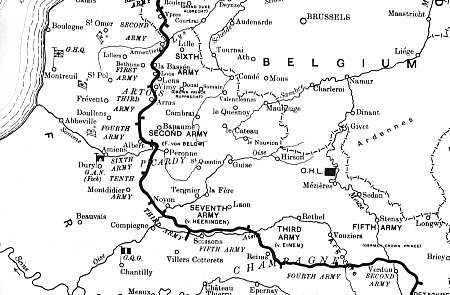
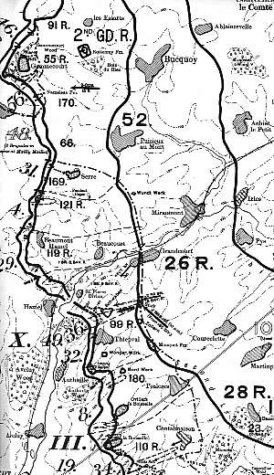